


The Four Corners of the United States
One of the fun things we did in our travels (over the course of four years) was to go to the extreme northernmost, southernmost, easternmost and westernmost points of the continental United States.
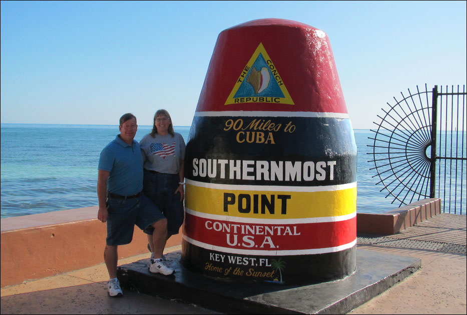
Below: The southernmost point, Key West, Florida.
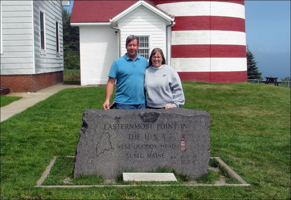
Below: The easternmost point, West Quoddy Head in Lubec, Maine.
Below: The westernmost point, Cape Alava, Washington. This was the most challenging point, requiring a 6.6 mile hike to get there.
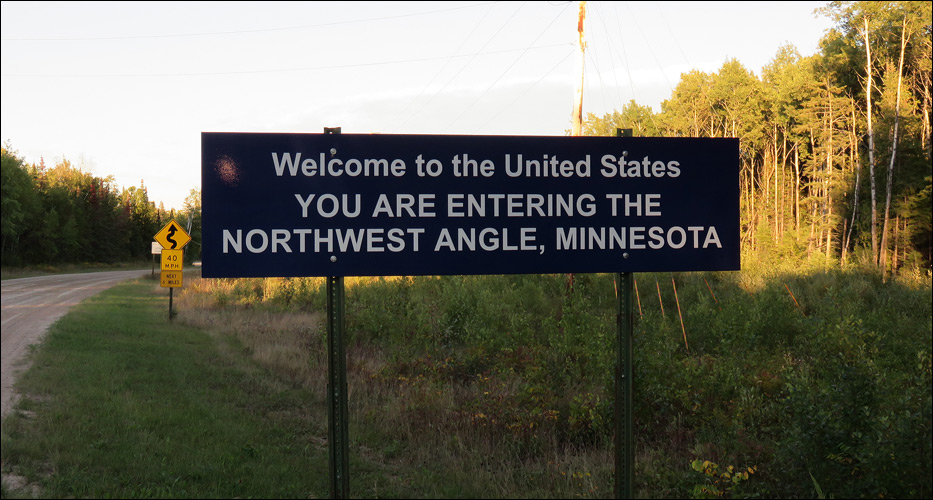
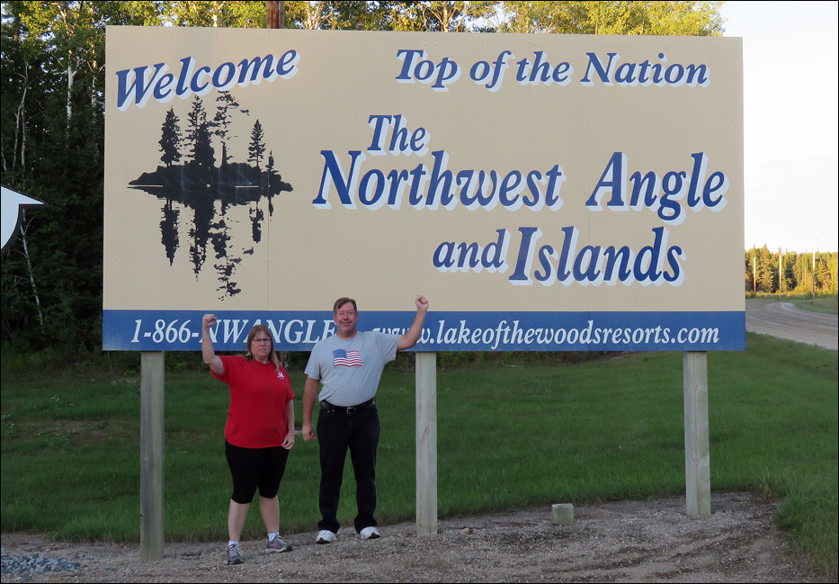
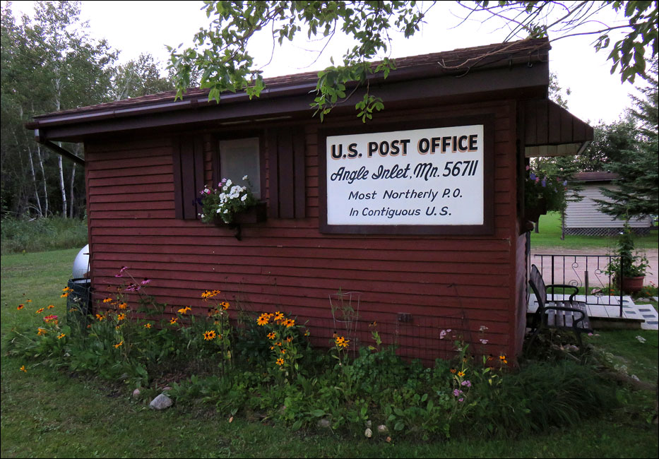
Below: The northernmost point, Angle Inlet, Minnesota. This was the strangest of all the extreme points. For starters, you have to drive through Canada to get there which requires a passport and four trips through customs.
Since we were having fun with geographic extremes, we decided to travel to the geographic center of the United States … which gets a little dicey.
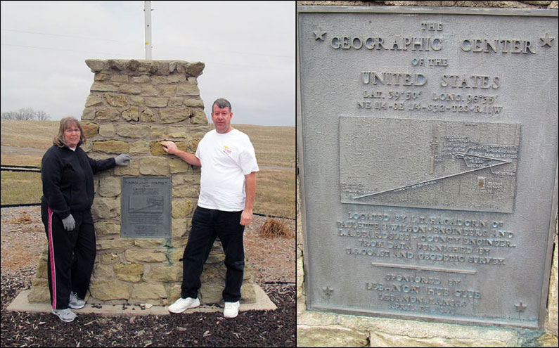
Below: In 1940 this marker was erected near Lebanon, Kansas to denote the geographic center of the United States (there were only 48 states at the time). However, no survey was taken to get the spot right. Instead, a county engineer took a cardboard cutout of the United States and balanced it on the tip of a pin. Where it balanced, he decided, must be the center. Fortunately two more states were added in 1959 making his decision moot.
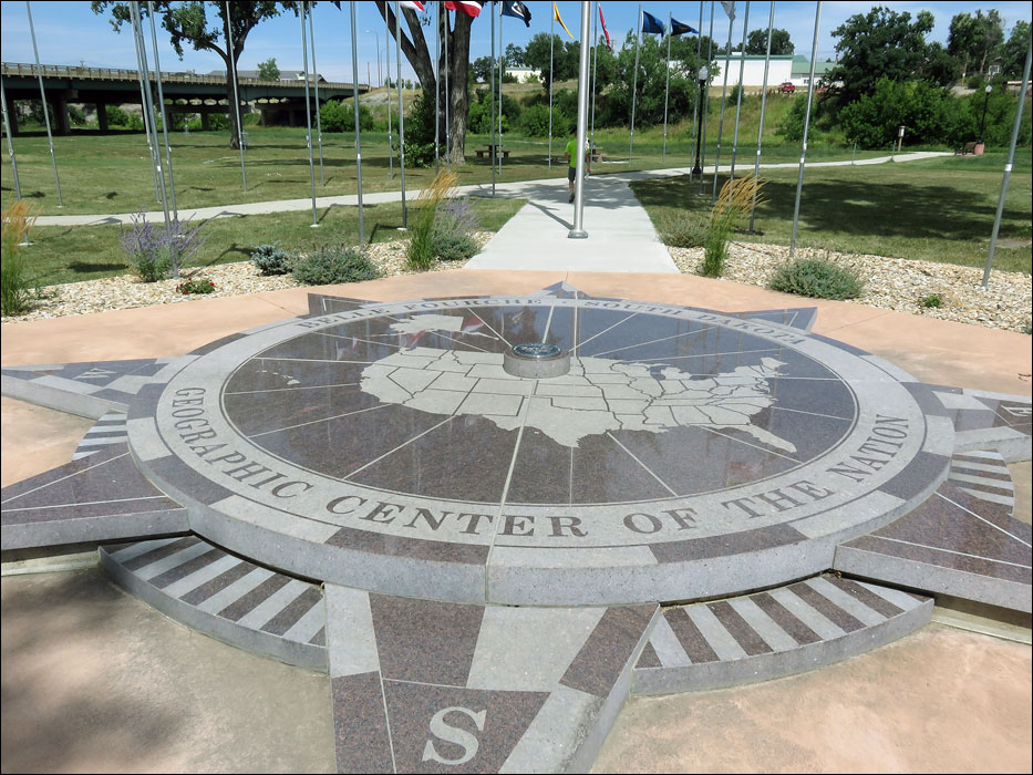
Below: Belle Fourche, South Dakota lays claim to being at the geographic center of the 50 United States. At the Visitors Center you can get your picture taken next to the giant marker that reads “Geographic Center of the Nation” which is surrounded by all 50 state flags. Very impressive. However, by their own admission, this is not the geographic center of the nation.
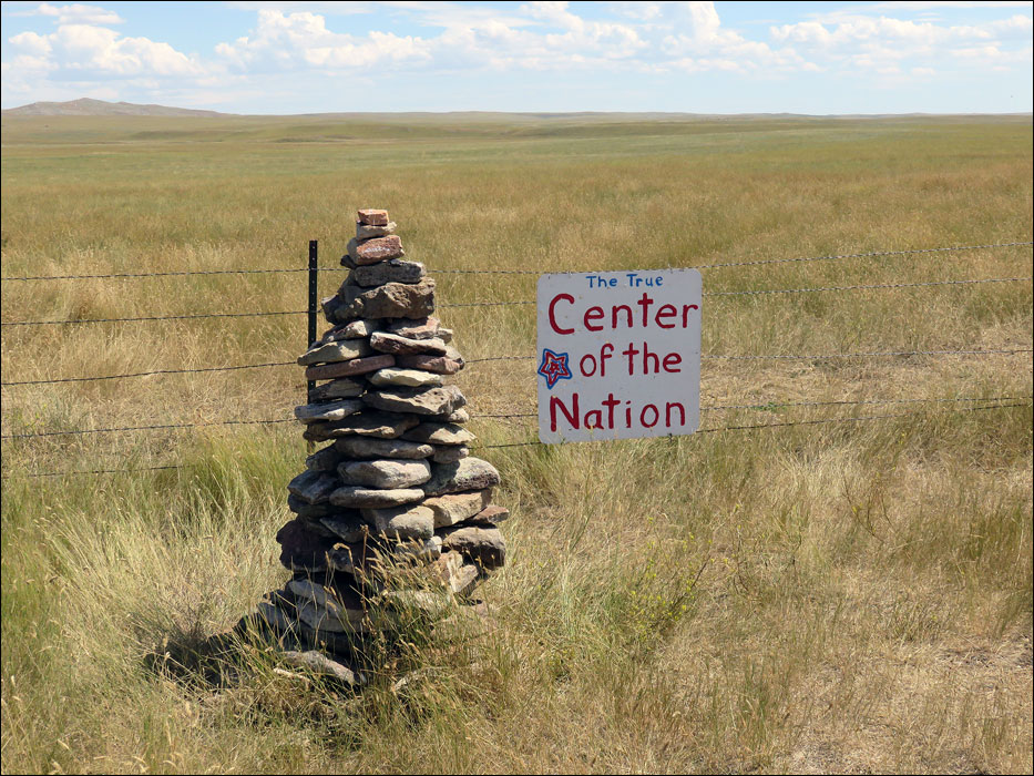
Below: At the Vistiors Center they will give you a map to find the real geographic center which is over 20 miles away out in some ranchland. When you get there you find this sign, and marker, which gives you the impression that you are at the real geographic center. Nope, that's not it ... but you're close.
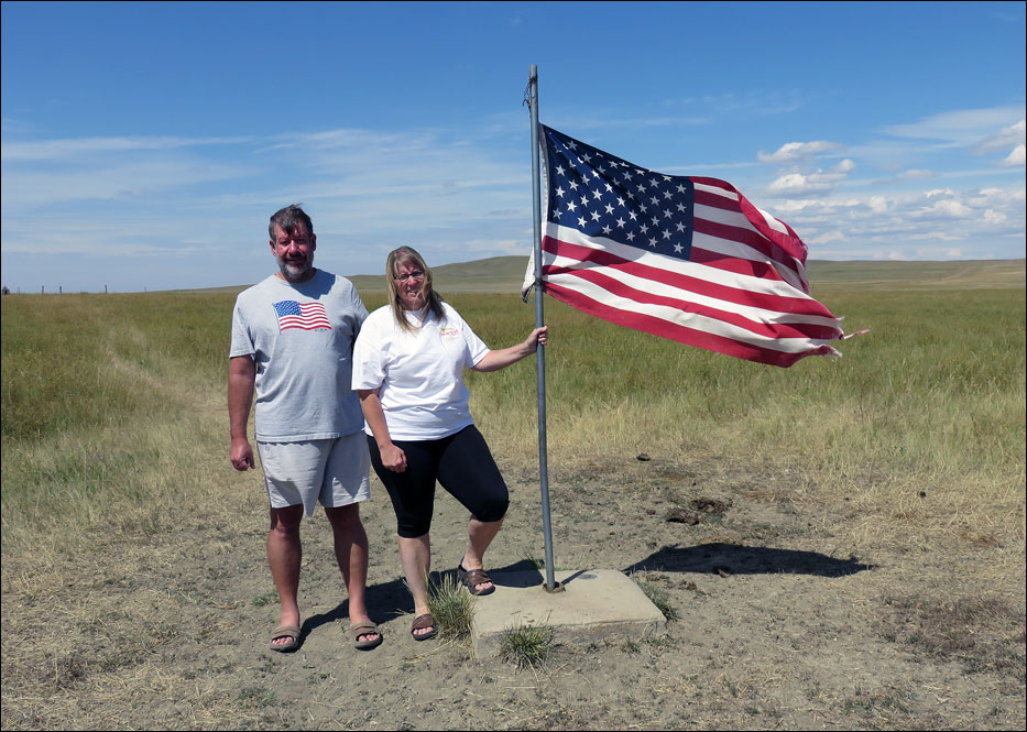
Below: To get to the real geographic center you have to hop the barbed wire fence and walk 200 yards out to the middle of a pasture where you will find a U. S. flag and a USGS benchmark that reads “Center.” Now you’re there! Or rather ... nobody is there! Why haven't other tourists discovered this exciting free attraction? (The grass around the flag was trampled by cows, not people.)
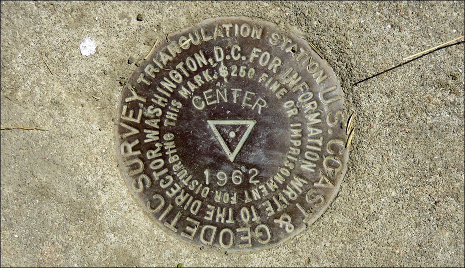
Below: This benchmark is embedded in the cement flag stand. We are to believe that the little dot in the center of the benchmark is the exact geographic center of the nation (assuming no cow has kicked the flag stand since 1962).
Below: A similar oddity exists at Four Corners, the only place in the United States where four states meet. Here (for only $3.00 per person) you can be in Colorado, Utah, New Mexico and Arizona all at the same time. But, unfortunately, due to mapping and surveying blunders 100 years ago, the marker is not in the correct place. The real Four Corners is 2.5 miles away on the top of a butte. After discovering the error, instead of moving the marker, authorities in all four states have agreed to pretend that this is their state boundary. I think this decision was made based on the fact that 1.) Americans are bad at geography and can be easily tricked into coughing up $3.00 for nothing, and 2.) Nobody really cares. Therefore, if you want to tour the United States you have to have a sense of humor and invoke the old Chinese proverb; “If you are happy, do not wish to be happier.”